Welcome

This web log contains the website content for our journeys on Reflections IV from April 2000 to December 2008.
Click there to start at the start.
Col, Liz, Courtney & Anna

Sunday, October 12, 2003

October 2003 - Singapore to Port Kelang

Photo SlideShow

Johor Baru & Singapore
While anchored in Johor Baru we met many interesting people. But the highlight was seeing a catamaran come in with the distinctive name of "Dave the Cat" written on the side with a black cat forming the 'h' in the name. On each bow was a kid. So as they passed us I shouted out "kids!". Courtney and Anna rushed up and so they were over on the cat meeting Shannon (10) and Simon (9). Roy & Libby have turned out to be great company for us as well. Also a Japanese man and his little boy came in. With Liz's Japanese skills we made contact with him. His story was very different one with the man buying the boat and aiming to sail it back to Japan. With not a lot of experience and a three year old aboard we felt concerned for their safety.

We did a few more tourist runs in Singapore, visiting the downtown area with Raffles hotel and a day at the excellent zoo. Another took us to the Applied Science museum, which also was excellent but overrun with young children madly running about and pressing buttons on the exhibits.

Heading out of the causeway we again were awed by the vast amounts and sizes of the shipping about. Once back in the Singapore strait for the third time we felt more comfortable as we held the edge of the shipping lane and made our way along. An interesting thing is watching the Singapore Air Force that seem to go round and round the island. With such a small country to fly around they must get there turns well practiced!


Kukup Island
A few miles into the Malacca straits we came to Kukup Island and anchored in between it and the mainland. This is a 'saltwater village' with most of the town, including the community hall and school, built out over the water. Large fish farm rafts skirt the waterfront and while anchored we watched the continual procession of workers dragging buckets of food and dropping it into the tanks.

As we left Kukup and very severe electrical storm passed us and we watched the 'real bad black end' of the storm pass slightly to the south of us. This was the start of lots of severe storms that we were to see in this area.

Coming up to the Water Islands, just south of Melaka, we decided to push on to Melaka and anchor off the town and go ashore by dinghy. No good - the steady onshore wind kicked up a steady wave and the idea of dinghying in was not appealing, given the hassles with leaks and motor unreliability plaguing us. So further north a mile or so we found a small island and anchored in the lee for a reasonably calm night. better to visit Melaka from another port.

Tanjung Tuan
From there we headed towards Port Dickson with a very pleasant stop at Tanjung Tuan for a night along the way. Ashore here we found a cute little beach with a basic picnic area in the bush. Following a trail up to the headland we passed a very old well and then came up to the lighthouse. A lighthouse has stood on this point for 600 years. Later Anna wrote and wonderful story set at this location called The Lighthouse of Tanjung Tuan.

After Tanjung Tuan a short trip of ten miles brought us to Admiral Marina, Port Dickson. This is a high class marina with all the trappings - pool, showers, water (drinkable) & electricity. This was the first berth we been alongside since Bali in March, and the first 'real marina' after Port Douglas in Australia. So easy just to step off and go for a walk!

Port Dickson & Melaka
From here we hired a car from one of the staff and drove down to Melaka. This is a classic historical town which has it's origins in the Portugese & Dutch Spice Trade efforts in the 16th century. Elizabeth and I had read a fascinating book called 'Nathaniel's Nutmeg' which gave great insight (from the english point of view) of the Spice Trade. Constructing your own walking tour is the go to see the different churches and museums. The maritime museum, built in the shape of an old dutch ship was a highlight.

The dinghy got more work with one side of the transom and the floor being re-glued into place. But at the same time we started to look at buying a new dinghy. After three days we left the marina and moved seven miles up the coast to anchor in four-five metres just behind a small island. That night a really savage storm blew through and for two-three hours we had lots of wind and the odd wave getting over the deck. later another yacht said they recorded 47knots on their instruments.


Port Klang & Kuala Lumpur

Port Klang is the main shipping port for Kuala Lumpur (KL) and as we approached the harbour we found huge amounts of rubbish and logs coming out. Without doubt this is the dirtiest harbour I have ever seen. The Royal Selangor Yacht Club is a fancy name for a yacht club which has a very stylish clubhouse and very basic boat facilities. Beside a series of pontoons at the front of the club, there are several large floating pontoons about 200 feet. The tides here are five metres which gives a tidal current of up to four knots, making docking and manevouring very difficult. We tied up on the outside of one of these pontoons and set about to visit KL. This is easy from here as the modern commuter trains have a station nearby.

Next to the yacht club is a large cargo port with lots of large timber cargo boats that ply between Indonesia and Malaysia. We watched many of these boats swing round madly as they rushed past on the current.

We met Nerthus a Swedish boat with Kent, Annica and their two daughters Emma (14) & Amanda (11) in Port Dickson and set out with them to see some of KL. We had a nice day and quite enjoyed the sights of KL. The twin towers of the Petronas building are the main attraction and we went up to the skybridge which links the towers on the fortieth floor. Chinatown and a Hindu temple were also excellent 'wandering material'.

We were soon joined by Dave the Cat, who had plans to visit the Highlands areas inland from here. After a few days we were sitting in the boat discussing whether to join them or move on when all plans changed dramatically.

These events warrant a new page

Sunday, September 14, 2003

September 2003 From Thailand back down to Singapore

Photo Slide Show
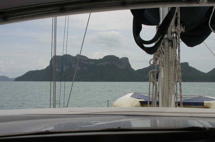
From Koh Tao a short run of twenty miles south west brings us to Ang Thong Marine National Park. This uninhabited chain of islands has many islands clustered together with high sheer limestone cliffs which overhang the shoreline where the waves have eroded the shore line.

Ang Thong Marine National Park.
We sailed along, and following our Sail Thailand cruising guide, found an anchorage off a small beach at Koh Wua Ta Lab. The one shame about the area is the water is not very clear. The bottom is fine grey silty mud so the holding was good but the snorkelling fairly poor. In the afternoon an inflatable with four national park officers called on us and pointed out that we had to go to the ranger station on the next island to pay a park fee. But tomorrow will be ok. Nice and relaxed guys.

Moving around to the ranger station at Koh Ang Thong we found quite a busy scene. The beach was packed with people and over forty kayaks were plying the waters. Each day six or seven large speedboats with ten or so people aboard come over from Koh Samui for the day. Going ashore we paid our park fees (A$24) and had a wander around the very pretty picnic grounds set up for the day trippers. After the crowds had gone we climbed up to have a look at the limestone caves in the cliffs overlooking the beach. This was worth the effort and the view from the caves is very impressive.


The guidebook mentioned a walk to the top of the island for a stunning view, warning to wear good shoes and carry water. With this advice heeded we set out. The sign at the foot of the track stated the walk was 500 metres, which was technically correct. Our chart showed elevation we climbed to was 430 metres. So 70 metres across and 430 metres up. Sounds about right! It was very steep. A rope was ran along the path and this was needed to haul ourselves up. The girls coped amazingly well on this steep and difficult climb.

Most of it was at least in the canopy of the forest and along the way we spotted some dusty spectacled langurs (monkeys with with white rings around their eyes)

 But the view was absolutely stunning and worth the effort.

Moving on from Koh Ang Thong we returned to our original anchorage for the day to visit a lake that is in the centre of Koh Wua Ta Lab. This unique lake was formed by the roof of a massive cave falling in. The water flows in and out with the tide via an underground link. There is a  short climb up some stairs and through the narrow pass to reveal the lake, which was a really fun - and easy compared to the day before.

Koh Samui
Time to move on to Koh Samui. This was perfectly (not) timed with a squall that bucketed rain, killed visibility and blew far too much wind for our liking. Still only fifteen miles and we were back at the best anchorage at Koh Samui. The anchor chain bow roller had splilt in half and the first treasure hunt here was to procure a new one. Chasing up a part, getting something, fixed or made is always a challenge, but in a foreign country things can some time seem impossible. Armed with a photograph of the boat and the bow of the boat I hired a motor bike and steady made my way around the island stopping at any place that may have something that could be used. Eventually I found a small workshop that had both a lathe and a piece of nylon and after mutually drawing the design of the new roller, hands were shaken on a price. The next day I returned to find the new roller made up exactly as the drawing defined. The guys in the workshop were thrilled when I introduced the family and explained how we had all sailed from Australia.

One of the really enjoyable moments is when we talk to someone and watch their face light up with amazement when, through the language barrier, they realise we are on moderately little boat sailing the world.

In Thai tourist areas motorcycles are very cheap to rent, and for $12 we rented a two new bikes . We spent the day cruising (very carefully!) around Koh Samui. Checking out a few of the tourist highlights, we all  had a fun day out. The monkey show was very weak but the other things in the photos above were good to see.  Hold your mouse steady over the photo for the caption - same with all the photos in this website.


The last official task in Thailand (apart from visiting customs and immigration) was celebrating Anna's 9th birthday. She decided on a pirate theme so a treasure map cake was made, children dressed up and a treasure hunt was planned. The day went well and the girls loved darting about the boat to find clues and rewards.


Pengkalan Kubor & Kota Baru
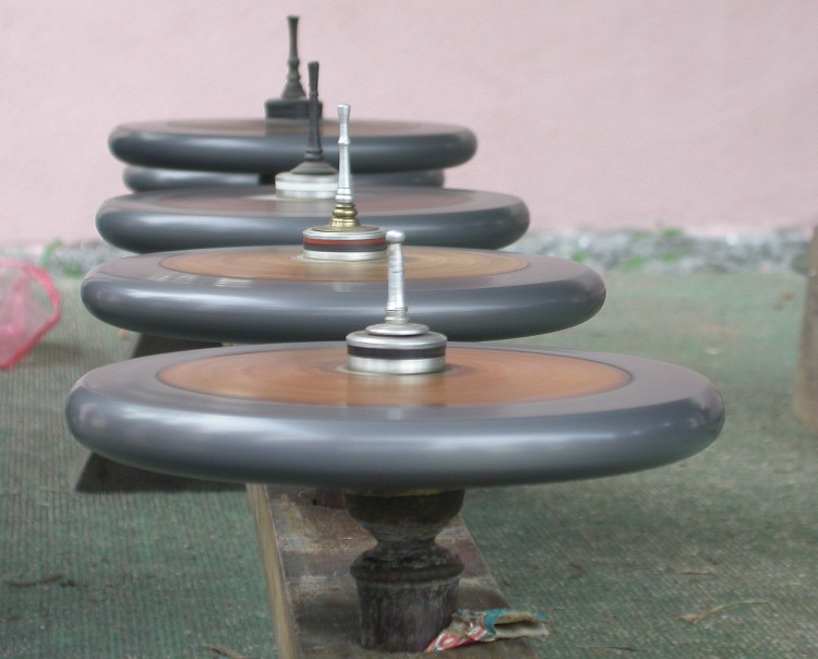
Full of sweets and birthday cake we were  ready to head south. We sailed straight from Koh Samui to the Malaysian border town of Pengkalan Kubor . Two days and sailing half the way got us there. Except for the occasionally 'blow your socks off' squall which comes with a vengeance and disappears just as fast, we had a very smooth trip. Back in Pengkalan Kubor we knew the drill for going ashore and finding fuel. So very quickly we had the tank full of fuel and the customs and immigration dealt with.  Our main excursion here was a trip down to Kota Baru for the down on the bus. We went to the cultural centre to see a display of top-spinning. With the girls having going through the 'Beyblade' craze they were keen to see grown-up men with big tops going for it.


The tops are about 20cm and must be full of lead as they are very heavy. Each group bind a rope tightly around the base of the top and with the effort of a discus thrower, they fling it to laid on a clay mound. The spinning top is then delicately lifted and transferred to the teams rack of tops. The are then 'maintained with oil and trim adjustments made as necessary. The tops spin for up to 2 1/2 hours.  The girls bought a small wooden top each and were shown the technique. The men were keen to show us all how to spin the top and even the older ones sitting back with a cigarette would clap or smile when they got a top spinning well.


At the same show we saw some teenage boys going through a ritual fight sequence that was like a ceremonial judo dance. The boys were very good and took their performance very serious. While all this was going a big group of men pounded away on beautifully painted drums.

   From the cultural centre we made our way down to the central market which is one of the biggest markets we've encountered. Always great to wander round the markets for a while.


 After fixing a faulty masthead light we made our way to Perhentian Island, only 30 miles away. We loved these islands on our way up and resolved to go for a scuba dive. We anchored off Long Beach - most popular with backpackers, and hunted round for a dive operator to go with. The prime site is a rock pinnacle a few miles away and known romantically as the 'temple of the sea'. We ended up going separately and I (Colin) went on a sunrise dive, leaving and dropping in the water before sunrise and watching the transition from dark to day while I was down. The visibility was very impressive with our torches lighting up 24 metres down from the surface. Courtney and Liz went for a dive on the same site the next day  but not as deep as Courtney is restricted to around 12 metres.  I hired a second tank of air and cleaned the bottom of the boat, making the job much easier and much more thorough

After stopping for water in a stream on the south side of Perhentian, we motored all day to get to Kapas Island . After a nice overnight rest in the good anchorage there we did a long overnight run to Tioman. We had another severe thunderstorm but generally had a good run, motoring for half the way and nearly always getting good motor-sail performance.

We came into Tekek Bay and found all the boats we'd met there three months ago. Katrine (Don & Jean), Kaiviti (Mike) and Valor (Don) were all ashore having a drink together when we found them. It was great to meet up with them all again. After a few days we moved on to SIbu Island. En-route our invertor died. It was alway tripping out on overheating and although a 300watt unit, it could not cope with the almost constant load of the computer power supply of 60w. I should have mounted an additional cooling fan.  So back to paper charts. What a pain. Computerised charting is so much easier and more accurate as the computer plots your position every minute. Still this is why we carry paper charts. From Sibu we had another overnight stop  at Jason's Bay with Katrine along the way to Singapore. We caught up a  Spanish Mackerel along the way so Sashimi and BBQ fish was for dinner with Don & Jean. A great way to end our four month cruise of the east cost of Malaysia/Thailand!

Winds and currents were very kind to us, and we covered the seventy miles to the eastern side of the causeway separating Johor Baru and Singapore  in 10 hours.  Anchored around us were eight other yachts. We were back on the main road! Most of these boats had just sailed across from Indonesia and were heading up the west coast . Over the next few days a few social get-togethers were held on first  'Bongo-Bob's' and then on Katrine. It was great talking to all these different people and trading stories.


Friday, August 01, 2003

August 2003 The Gulf of Thailand


Photo SlideShow


Pengkalang Kubor, Malaysia
The most valuable piece of information we gained from Jim off Remington was a mud-map of the border town Pengkalang Kubor and river entrance. This appeared on our chart as just coastline but in reality this is a proper breakwater formed harbour, well set up with leads and lights.

Our second trip from Perhentian Island was hindered by motor problems - this was the first time in the four years we've had the boat that the motor has just stopped. The fuel level was low and the fuel lift pump was not up to the task. Temporary adjustments got us under way OK.

We came into Penkalang Kubor and had our first views of Thai longtails. These boats have long shafts with exposed propellers that are lifted in and out of the water to stop the boats. We anchored in "no-mans water" with Malaysia to the south and Thailand to the north. Going ashore was a matter of landing at the immigration checkpoint and explaining we were on a boat in the river and they let us through.
 

First thing was to get some fuel. Inquiries at the harbour-master's office and a trip in the dinghy and a small shipyard with a bowser on a jetty was found upstream in a small inlet. We crept in the shallow waters and just got alongside the fishing boats. We got our fuel and enjoyed checking out the fishing boats which are built incredibly strong with two-inch thick timbers. We usually have popcorn for morning tea so we made extra for the fishing boat crews, who responded by giving us a few packets of noodles. When the fuel man was finished he gave us a large bottle of drinking water as a parting gift. So nice to do business in such circumstances.

Back in the river ashore a duty-free shopping centre was found. The big drawcard was alcohol, which is 50% cheaper. Liz and the girls had a day in Kota Baru to visit the Museum of Royal Customs and a quick look at the markets which was cut short by two sensitive noses disagreeing with the smells. They reported it was worth it just for the bus trip in as they saw several beautiful Wats - Buddhist temples. A taste of what was to come in Thailand.
 

We went over to the Thailand side for a wander and although this was fun and we had a nice Roti (flat bread) dinner in the markets, the complexity of clearing Immigration for an hour visit was a bit much. We caused a bit of confusion back at the Malaysian side as we now wanted to have our passports stamped to reenter. They wanted to just let us in and couldn't understand why this time we needed entry stamps in our passports.

Saiburi, Thailand
 The next day we headed out north. The weather was fine and we had a pleasant sail up the coast. We came into a small inlet at the town of Saiburi. This was, like Pengkalan Kubor a well defined breakwater. The Lonely Planet book noted that this area was well known for the decorative paintwork on the fishing boats. We had front row seats to study their work as they passed us on their way out to fish for the night. Our 'royal wave' was well tested as the procession passed us waving cheerfully.
 

Not long after sunrise we were woken by the engines of the fishing boats returning. With the tide slack we were laying sideways across the waterway so we thought it best to get going. Another good sail and we were now 80 miles north of the Malaysian border when we reached Pattani. We had no information on anchorage or the harbour entrance, but as we arrived we noticed a large commercial vessel leave, so the channel should be deep enough for us.

But not the way we went! We touched the sand and muddy bottom and got stuck. Getting off by spinning the boat at 90 degrees to the wind and hoisting our sails to lay the boat over worked well. Following the port hand side of the channel, we made our way in. The river was moderately wide but was chock-a-block with fishing boats, so much that we couldn't find anywhere to anchor. Making our way back out we found a spot behind a sand spit and anchored for the night.

Songkhla
  Pushing on to Songkhla was just another day on the move, highlighted by catching the largest spanish mackerel yet. We came into this major port with no problems. The harbour was very busy with car ferries, fishing boats and large ships all buzzing about. Every few hundred metres there was a row of fishing stakes protruding out into the harbour. These are arranged so that to go up the harbour a constant zigzag has to be performed. We were thrilled to see the large Buddhist temples and shrines around the city as we went along.


Wandering round our first Thai city was great fun. New sights and smells everywhere. Songkhla harbour continues on to open into a large inland lake system which is vast, covering thousands of square kilometres. We went to the island of Ko Ro which is just outside of Songkhla and connected to the shore by long bridges. There is a folk museum there, which concentrates on art and culture of southern Thailand. The museum is set on a hill which gives wonderful views of the surrounding inland sea. Starting at the top the museum leads you through a series of rooms showing off most aspects of Thai history and cultural practices of today. Also stunning views of the villages and inland sea are everywhere through the large windows in many rooms. Very good.

As with most Thai cities (we assume) Songhkla has many fine wats and temples and worth a wander around. We found a large market with lots of 'finger-food' and, while we weren't always sure what it was, some delicious tastes were found. The variety of seafood was incredible with large tiger prawns and unusual fresh water fish.As with most photos in this web site, hold your mouse steady over the photo to see the caption describing the photo.

While at anchor in the harbour the sound of firecrackers going off were heard all the time. At first we thought it was a celebration of the queen of Thailand's birthday but later we noticed the fishing boats were the culprits, letting off a string of crackers off the bow as they left. As we left Songkhla a large boat in front of us stopped repeatedly to let some off. From Songkhla an overnight trip brought us to Koh Samui.


Ko Samui
The area where Ko Samui lays has several islands around it: Samui, Phangan to the north, Tao to the north west and the An Thong islands to the west. I (Colin) came here in 1988 and the increased development since my last visit has made the place almost unrecognisable.

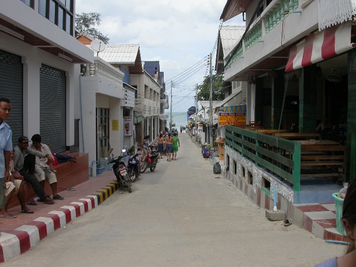
We first anchored at Bo Phut on the north eastern corner of Samui and it seemed the wind intensified as we came in to anchor. This was a good anchorage and although the wind was blasting over the deck the water was calm. There are (as with every peice of sand on Koh Samui) resorts/restaurants lining the beach and we found this was a quiet place with many families about. European languages seemed to dominate the air. We made our way to NaThon, the ferry terminal town, by sawngthaew - small utilities with bench seats in the back. Here we checked in with Immigration and Customs and collected the girl's schoolwork.


We stayed at Bo Phut for a few days and on the radio heard two yachts we knew (Kaiviti & Valor) who were in Chaweng which is the main tourist strip. We went around to see them and the busier part of town to find a very rolly and windy anchorage. The beach landing in the surf provided too much of a challenge with Col ending up face first in the wet sand! Chaweng is one long strip of shops offering souvenirs, CD & DVDs, clothes, shoes, Thai massages, travel agents, Internet, motorcycle hire, and food. Normally all in the same store! And a McDonalds of course.

It seemed terribly similar to the streets of Kuta, Bali. Bo Phut was a much nicer place in all regards - pace of life and quality of anchorage.

Ko Phangan
After a night of being tossed around in our bunks we moved north to Koh Phangan the large island north of Koh Samui. We went into Haad Rin, on the south east corner. We found Jim on the yacht Remington here and it was good to catch up with him. I (Colin) stayed here in 1988 and the change was incredible. Then there were around 500 rooms on the island. Now there are 5000!


The have a huge party each full moon on this beach with thousands of people partying and sleeping on the beach. All the stores have large displays of booze for sale, so it must be quite a night.

From there we had a lunch stop at Thaansadet, a small beach with lovely waterfalls. Several of the kings of Thailand have had holidays here with inscriptions on the stones a big draw card for local tourists.


From Thaansadet a short trip of a few miles brought us to Haad Thong Naay Paan. This is a very protected bay and a good night's sleep was enjoyed by all. The bay has lots of resorts ashore and the beach has fine sand and we stayed here a few days to catch up on a few jobs and schoolwork. We ate ashore a lot and enjoyed sitting in the beachside restaurants in the cool of the evenings. English was seldom heard as the customers seemed to be mainly European. Luckily the girls found a pair of English children on the beach and this made trips ashore all the more fun for them them and the boys to have someone to play with.


We moved on to the next bay only a few miles further north before moving on twenty miles north to Koh Tao. This island is well know for diving with the water much clearer than Samui or Phangan. This was very obvious when we arrived at Mae Haad, the only town on the island. For the first time in ages we were able to drop the anchor in 8 metres of water and watch it hit the bottom and the chain lead away as we dug it in.

Koh Tao
Mae Haad is a small town with possibly the highest concentration of dive shops on the planet. It seemed every second shop was a dive shop. The explosion in development is fairly recent and is clearly focused for the majority European tourists, with quite a few classy looking cafes on the street with some fine looking pastries in the window. Interesting how lots of tourism tends to remove the culture they came to see and replace it with their own.

After doing some shopping we moved over to Koh Naang Yuan, a small group of three islands just off the Koh Tao coast. These three islands are joined at low tide by small sandy beaches. A resort occupies all three islands and the whole place is incredibly scenic. We decided to let Courtney do a dive course here. At the tender age of 11 she is old enough and, we feel, sensible enough to go diving. She was over the moon about this and worked hard at the course. She proved very confident and capable with her instructor being very impressed. Liz went on the last two dives with her and commented that she was a pleasure to dive with.


The dive course package included accommodation so we had the luxury of a unit in the forest overlooking Koh Tao as a land base for three days.

Liz and I also went for a dive Chumporn pinnacles, large rocks that tower up from the bottom (35 metres) to 20 metres below the surface. This was marked as the best dive in the area and although it was very enjoyable it was not so fantastice. We arrrived at the site with about ten other dive boats there and we guess that there were 30 other divers in the water with us.


Most of the photos on the web are taken by Colin but these two gems were set up and shot by Anna with the self-timer.


Photo SlideShow


Sunday, June 15, 2003

June 2003 Up the east coast of Malaysia - continued


Photo SlideShow


Tioman Island
After three weeks we finally reached our first milestone of an east coast cruise - Tioman Island. This is a large island with several kampongs (villages) and several anchoring options. Many people come here for holidays and there is a variety of accommodating here. We needed a few supplies and hopefully beer at a reasonable price.

We sailed across from Sembilang/Sribuat islands and anchored in Tekek bay. We mucked about anchoring as it was deep (14metres) and shoaled to reef very quickly. Once satisfied we went ashore and were please to find small supermarket which had what we needed and not much difference in price compared to the large supermarkets in JB. Tioman is a duty-free island for beer and cigarettes. We picked up a case of Carlsberg cans for RM50 (A$22) which was much better than RM106 in JB.

That night we had clouds build up over the island which looked ominous. Later that evening after some rain the wind picked up and shifted suddenly. Feeling the boat slew Liz and I got up to check all was OK. Don's full keel ketch Valor was laying abeam (side-on) to the wind in front of us. Liz shouted that he was dragging and by the time I'd walked to the bow it was clear he was going to clean us up. I shouted out to raise him and he popped up from the other side of the boat, having just returned in his dinghy from dinner on Katrine.

As the boats came to touch Liz and I jammed fenders between and Don got his motor going. The boat slowly crabbed over the top of us and I held my breath as the stern went over our anchor chain. Don's boarding ladder jammed into the chain and smashed itself to bits. He then got clear of us and headed out to deep water to winch his anchor up. On the radio he then reported his dinghy was missing. We searched by spotlight that night and then along the shore in the morning but with no luck.

In the morning we only found the timber barge board along the gunnel of our boat chipped and no other damage. Valor sustained no damage except for the loss of the ladder and dinghy. In a way he was lucky to have come onto us as the reef was a only a short distance behind us.

The southerly wind blew up each afternoon and made the anchorage a bit uncomfortable so we moved a short distance north to anchor in Teluk Salang (Teluk is the Malay word for bay). This was not a lot better and crowded with fishing boats so we continued on right around the island to Juara Bay on the eastern side. We tucked in the southern corner and found it a bit rolly from the swell. We planned to stop a while so we went to the trouble of setting an anchor off the stern to hold the boat pointing out to sea with it's bow into the swell. This worked really well and we had a very comfortable two weeks here.


There are many small cabin style resorts with basic amenities up to air-conditioned units. These are relatively small and have a low visual impact making the bay look very picturesque. The Kampung (village) of Juara is well catered for with electricity, water, an excellent jetty with water and a concrete path running the length of the bay, which is effectively the main street..


In the corner of the beach there was a fresh water stream which was accessible in the dinghy at high tide. A few hundred metres upstream there was a small hydroelectric power station. The outfall of the power station became a daily destination as it was a great place to do laundry and have wash. The trip was very pretty with a large banyan tree overhanging and lots of wildlife. We saw many monitors and smaller lizards, macaques and kingfishers.

We saw some interesting groups come to stay. The resort closest to us had over a hundred Muslim clerics (we assume that's what they were) come for a three day stay. At each of the five prayer sessions they would gather in a room and chat and dance for about an hour. Quite an effort for three days. After they left we heard on the VHF radio an Australian accent calling "Warship Norman". Soon we saw several Naval vessels come in the bay and then they started coming ashore and unpacking gear. We learned that the Australian, NZ, Malay, British & Singaporean Navies we all together for annual exercises. Juara was the site for the dive/mine hunting teams. So for the next ten days they set up flags around the bay and did their stuff.

One night Liz noticed lots of their inflatable boats buzzing around. After retiring, she heard a motor close by and when she got up to investigate she saw a red light in the water underneath the boat. The divers surfaced and held on to our dinghy and said "It's OK we're just doing exercises". They were Australian as it turned out. The next day while ashore a senior officer came up and apologised. While there was no harm done and with so many of them in the bay it was clear who they were, the situation would have been quite different if we had just arrived and were unaware of the exercises. Being robbed at night by someone boarding the boat is a real concern for cruising yachts and many carry weapons.


Tulai Island and on to Kuantan
Over the next few days the military things started to wind down and we started to think about moving on. Liz and the girls walked over the island and I sailed the boat round to Tekek to meet them. While they enjoyed their walk and the motor bike ride up the path on the eastern side, they weren't so impressed about the torrential rain they. Meanwhile, on the boat I had a quiet relaxing trip around in sunshine.

Katrine was there and another yacht named Namir. Namir is from Keri Keri, NZ and has Bob, Joanie, Lisa (11) and Ryan (16) aboard. They were making their way south after going up to Koh Samui. Lisa and the girls got on well and we had her for a sleep-over and she sailed with us to Tulai island just five miles away. Tulai has excellent coral reefs and is as good as we've seen anywhere in Malaysia. We also enjoyed snorkeling in the mangroves at high tide, watching the mangrove jack swim in and out of the tree roots. Quite a different experience.

The next day Namir left and we had another day at Tulai but always with an eye on the sky as the anchorage is not great. Sure enough the next morning we had gray skies and the squalls started to come in. After an hour or two of squalls we decided to 'bug out'. Destination unknown. The girls asked Liz and I where we were going to go to and we truthfully admitted we didn't know. We ran north with over 20 knots of southerly behind us with just the headsail. If the wind stayed up we'd just run with it and continue north. Not long before dark the wind eased and the main went up. The boat was trimming along smoothly now and we decided to reach across to Kuantan on the mainland.

We anchored at 3:00am in an open bay just north of the Kuantan river and had rolly sleep. Next morning, with a rising tide we went into the river. Our 'mud map' - a sketch passed down from yacht to yacht, told us to go the wrong way around a port marker. We also had been told the the larger 'C' class fishing boats (they have a big C painted on the side, draw enough water to stay in the main channel so we followed them in. Luckily we saw that the channel had changed and we followed them several hundred metres to port of the marker. Liz updated the sketch accordingly.

We spent several days at Kuantan and enjoyed the calmness of being anchored in a river. To get ashore we had a long trip in the dinghy up to a public ferry jetty. This put as at the bus station and pretty well in the middle of the city. The main mosque is the big landmark and the soft blue/gray colours make a stunning sight. After checking out the shopping malls and wandering the streets, and collecting some supplies of food we moved on further up the coast.


Chukai
A 35 mile trip along the coast brought us to Chukai, once again on a river. This entrance was simpler as there were leading marks which proved to be correct. The main settlement is about a mile up the river. Surrounded by forest the river had many eagles soaring over it and we could see the branches swing with monkeys in the forest. We anchored just off a park and were only metres from the middle of the town. We stayed just the night and moved on.

The next day's sail was very pleasant. We had light southerly winds and sailed all day. The coast line seemed to be one long beach broken occasionally by a headland. At one point we passed a huge a refinery complex with burn off chimneys blazing and a large tanker on a mooring close to the shore. The chart showed a large oil/gas field offshore and many submarine pipelines feeding in. Much of Malaysia's wealth comes from oil revenue.

Kapas Island
60 miles up from Chukai was Kapas Island. Our dream sail with steady winds all day changed with the onset of an afternoon storm. The island wasn't too far so we dropped our sails and motored the last few miles into the blackening sky. The storm had passed over as we arrived and, in the dark, we spotted some boats moored and picked a spot just out side of them. Next morning we moved up to the northern end of the island and found beautiful bay formed by Kapas island and a smaller island nearby. This bay was deserted and girls enjoyed taking the dinghy ashore to play on the beach.

This is a very popular island for the residents of Kuala Terrenganu. We found camping grounds here and small resorts. This was the first place we've seen Malaysians camping. We watched a youth group of boys and girls erecting tents on the beach which reminded us al lot a school camp we went on with the girl's school in Brisbane.

Kuala Terengganu
Kuala Terengganu is the capital of Terengganu state and is set on a river - so we could go there! The entrance was straightforward and we anchored just inside river entrance. We found a really great market with a football field sized fruit/vege/fish market and upstairs narrow crowded crafts/clothes shops going everywhere. The Chinatown area was fun to explore and Liz found some pork meat and other Chinese supplies.

We went to the state museum which was very impressive. The buildings are large concrete structures built in the style of traditional buildings with large reliefs and ornate gables, all set around large beautifully kept gardens. Inside we saw displays on textiles, dress, music, jewelry and of course, a history of the local sultans. Sponsored by Petronas, the state oil company, there was a large building dedicated to how beneficial the oil industry is.

A visit to the ports officer confirmed that we didn't need to clear Malaysia here but at the border town of Pengkalan Kubur


Redang Island
From Kuala Terenganu we had a long sail/motor to Redang island. We'd set out early and arrived in the north east bay just before dark. The bay was very deep in shape and high hills provided good protection. Which was why there were so many fishing boats in the bay. They raft up together and then run a line back and another group raft up. We counted eleven rafted alongside each other.

That night a squall blew up and with thundering rain, the wind bulleted down really hard and from different directions. We held our ground OK and luckily the fishing boats did as well.

There are two beaches of fine white sand on the shore. One is the site of a large high class resort. Going ashore the girls eyed the swimming pools and the next day they played 'resort guests' for the day, lounging in and around the poolfront.


Perhentian Islands
We sailed across the twenty miles from Redang Island with the big event being we caught a fish! A lovely big spanish mackerel. We were technically inside the marine reserve area when we picked it up. Once we anchored a large police boat anchored nearby and they started fishing off the back. So much for the no-fishing rule.

The police boat was at least 30 metres long and one night we had a squall come up and the police boat dragged past us and only was metres from the reef when they rapidly reversed away. We suspect they were having trouble getting their anchor up.

We found the snorkeling excellent, with very clear water and lots of large plate coral formations and many more fish than we've seen elsewhere. There lots of restaurants and chalets ashore and most have a dive shop as well. A dive with gear costs 70 ringgit (A$30).

There are two islands here and we were are in a bay within the channel between the two islands. With beautiful white sand beaches and rocky outcrops on the points of the bay it is a very picturesque place.

At one of the dive shops Liz met a British family on a working holiday. They had a seven year old boy, Jack, who enjoyed playing with the kids. One day he turned up at the boat with his schoolwork. He was cagey when we asked if his Mum & Dad knew where he was but assured us everything was OK. Later that day his mum, Noeline, turned up and told us that he'd told the staff in the dive shop where he was going and hitched a ride on a boat out for the visit. Still, he got a fair bit of work done.


Kota Baru
We left Perhentian,sailed to the coast and anchored off the beach. The river was too shallow to enter so this was the only way to visit Kota Baru. We went ashore, found a bus into town and found what the girls described as Nirvana. A McDonalds with and Internet cafe inside it. Of course it was called McCyber's.

Kota Baru is considered the centre for Malay culture and also has a more strict Islamic regime. The cultural centre holds regular concerts and we enjoyed hearing the different instruments. The singing however was another thing and after a couple of songs we slipped out.

A storm had gone through while we were ashore, and on return to the beach the sound of the surf was ominous. We prepared for the launch... a quick jump in, row like mad while the motor is prepared for a start. It all went well until the top of a wave just got us and threw a bucket of water over the motor. Continue rowing like mad. We were away! But a second break was still to be crossed. Success but substantially wetter.

At the boat we found our home tossing around madly. Getting aboard was a matter of timing.... Wait for the gunnel to come down. Step on and zoom... up you go! That night was the worst night's sleep we've ever had. The boat tossed and rolled irregularly, with the waves and a swell rebounding off the beach. The dinghy got covered in anti-fouling painting as the boat rolled and the the dinghy wiped against the exposed bottom.

The next day was gray and threatening. We motored up towards the next harbour at Tumpat. As we approached it the wind intensified and the idea of risking entry into the harbour which was very shallow (three metres on the chart) was not appealing.

So, tired and exasperated, we turned round and ran downwind the thirty miles back to Perhentian. The strong winds (20-25 knots) were fine as tail winds and the sail back went well. This turned out fruitful as we anchored at Long Beach on the larger of the pair of Perhentian islands. This is a backpacker hangout and there we met Jim off the yacht Remington who had lots of information on the coast north to Koh Samui.

Time for a new web page that takes us to Thailand.


Wednesday, June 04, 2003

June 2003 Up the east coast of Malaysia


Photo SlideShow
We headed back down the Johor Strait from Johor Bahru and rounded Singapore island. There is a seriously large amount of shipping plying these waters and our boat seemed very small as we made our way along the edge of the shipping lanes. We had no dramas but it was an exhausting day keeping track of where each ship was going.


The Seribuat Archipelago 
After clearing Singapore we hoped to anchor for then night at some small islands just on the 'corner' of the Malay peninsular. As we approached we realised it was no good with far too much swell to have any hope of sleeping during the night. So we pushed on, somewhat reluctantly but with no other choice. An overnight run would get us to Palau (island in Malay) Sibu. We had 10-15 knots of wind and running downwind in the lumpy swell was no good so we reached out a long way and then reached back in. This is a good strategy to get a more comfortable ride and so what if it takes a bit longer.

Sibu Island
We anchored out wide just before dark and then after breakfast went to the northern tip and found a beautiful calm bay to anchor in. There is a small resort here (Rimbu Resort) and we found the people there very welcoming. The girls were so pleased to be able to go swimming again - all of us were really. Later on in the day two yachts came into the bay and anchored. Mike & Sylvia off the sloop 'Kai Viti', and Don off the ketch 'Valor'. They had spent the last four months in Sebana Cove Marina near Singapore and were planning to do the same trip as us. Mike & Sylvia used to be TAFE teachers (I worked for TAFE NSW for nine years). During our stay the girls found some kids staying at the resort to play with and we enjoyed the adult company of the resort guests and the other yachts.
 

There are tracks from the resort to the other beaches/resorts on the islands. We went for a walk and a swim to the eastern side and had a very pleasant walk through the bush and a swim in the small surf.

Tinggi Island
From here we moved across to the nearby island of Palau Tinggi. This translates to 'tall island' and is dominated by an extinct volcanic cone. We anchored in the southwest corner. Here there was a school and other official buildings. The main reason for the village's existence must be the school as it was the vacation period and the place was almost a ghost town. Still it was nice to wander round and have a look about. There were no cars and two concrete paths made up the street network. Pot plants were everywhere, which gave the place a distinct style.

The weather pattern we encountered was the usual steady southerly wind and a swell coming from the west. The trouble to find a good anchorage was to get out of the wind and the swell. At this anchorage we were open to the wind which was OK as the reef cut down the wave action, although as the tide changed we'd lay sideways to the wind/waves which was a bit unpleasant but tolerable.

The next anchorage was at the northern tip of Palau Tinggi with the hope of a calm bay like Sibu Island. We came into the bay and found a large rocky shoreline and, feeling a bit threatened by the 'hard edge' of the water', anchored out wide. The shoreline rose to meet to the volcanic peak of the island, giving a spectacular look to the anchorage, but.... While the wind was blowing we felt comfortable but that night in the calmer conditions we rolled around and no scenery could offset the lack of sleep from tossing about.


Tossing about when you're at sea is taken for granted - the price to travel this way, but tossing about when you're stopped is not on!

Babi Besar Island
We moved on to Palau Babi Besar Island. This had a lovely long sandy beach on the western side but the risk was we were open to the wind - but the beach looked very inviting. Going ashore we found several resorts along the now familial concrete path/street. The two up-market ones had signs stating they were closed to the public. The reason was they were booked out entirely by a Swedish film crew who were filming a 'Survivor' style series. The people hanging around the resort were quite unfriendly and had that "I'm at work therefore I am not enjoying this look" - even while in the pool with a beer in hand! There were several elaborate sets on the beach. The participants were 'stored' on another island and were brought in to complete their tasks.
 

Apart from the Swedes jogging around the island was very quiet with only noise being cows mooing as they roamed free. . We enjoyed a beer here and there and had a reasonable hamburger for dinner one night. We stayed three nights and although not the smoothest of anchorage the girls really loved the beach. A catamaran named "Katrine" came in and we all met Don and Jean while having a long chat aboard their very nice boat. They are South African and do some charter work and we hope we see more of this nice couple.

Leaving Babi Besar we all went separate ways. Katrine headed to Endau on the mainland to find a place to go to collect a charter group coming in a few weeks and Valour and KaiViti headed to Tioman as Mike had an ongoing ear problem that needed looking at. We just headed to the next anchorage. We ran across to Palau Rawa which looked very similar to Babi Besar, anchorage wise as it faced west and was open to the southerly wind. Resorts filled the beach so we decided to search on for somewhere less populated. Following the small chain of islets north of Rawa we saw only one possible anchorage which had tents erected on the shore. This was no doubt the 'Survivor' island so we moved further north.

Sembilang and Sribuat Islands
Our cruising notes described the next pair of islands with just these three words: 'very protected, fantastic'. No need for depths, waypoints, type of bottom or other directions. We stayed just over a week in the northern bay formed by a reef joining Sembilang and Sribuat Islands.

And it was very protected and indeed fantastic. We had no swell from the west and the wind blew strong over the deck off the reef pushing lots of fresh air through our wind scoop and into the boat. We found the snorkelling good and a long put off job of painting the deck got started. Katrine came in and stayed for a few days and we enjoyed a lovely tropical BBQ and fire on the small beach formed by a little cove in the rocks.

After a great week of 'true cruising just like in the brochure' we moved on to Tioman Island.

Photo SlideShow